Overview
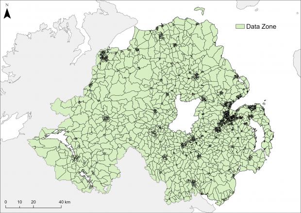
NISRA has developed two new statistical output geographies to support the dissemination of Census 2021 statistics, namely Data Zones and Super Data Zones.
There are 3,780 Data Zones (DZ2021) across Northern Ireland, which nest within the 850 Super Data Zones (SDZ2021). These in turn nest within the 80 District Electoral Areas (DEA2014) and 11 Local Government Districts (LGD2014).
- Read our information papers to find out how the new statistical output geographies have been developed, and how other Northern Ireland geographies can be approximated
- Person and household estimates from Census 2021 are available for Data Zone, Super Data Zone and District Electoral Area
- Census 2021 population-weighted centroids are available for Data Zones
Data Zone digital boundaries in GIS format
Users are able to download Data Zone digital boundaries in a number of formats:
- ESRI Shapefile
- GeoJSON
- Geodatabase
Data Zone attribute table
| Attribute | Description |
|---|---|
| DZ2021_cd | Data Zone code |
| DZ2021_nm | Data Zone name |
| SDZ2021_cd | Super Data Zone code |
| SDZ2021_nm | Super Data Zone name |
| DEA2014_cd | District Electoral Area code |
| DEA2014_nm | District Electoral Area name |
| LGD2014_cd | Local Government District code |
| LGD2014_nm | Local Government District name |
| Area_ha | Data Zone area (hectares) |
| Perim_km | Data Zone perimeter (kilometres) |
Geography preview

